Unlocking Precision: Aerial Photogrammetry Services in Nigeria
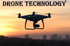
Aerial photogrammetry, the science of obtaining accurate measurements and 3D models from aerial imagery, has emerged as a game-changer in various industries worldwide. In Nigeria, this technology is rapidly gaining traction, offering innovative solutions for diverse sectors such as urban planning, agriculture, and infrastructure development. Aerial photogrammetry services in Nigeria utilizes advanced drones equipped with high-resolution cameras and LiDAR technology to capture detailed images and data from above, revolutionizing traditional surveying and mapping methods.

Agriculture is another sector experiencing
transformative impacts from aerial photogrammetry services. In Nigeria, where
agriculture remains a significant contributor to the economy, optimizing land
use and crop management is crucial for enhancing productivity and food
security. Aerial photogrammetry provides farmers and agricultural experts with
detailed insights into soil health, crop health, and water distribution,
enabling targeted interventions such as precision irrigation, fertilization,
and pest control. By leveraging this technology, farmers can optimize yields,
minimize input costs, and sustainably manage natural resources.
Infrastructure development is also undergoing
a paradigm shift with the integration of aerial photogrammetry services. From
road and railway construction to pipeline and utility installations, accurate
surveying and mapping are essential for project planning, design, and
execution. Aerial photogrammetry allows for rapid and cost-effective data
collection over large areas, facilitating the identification of suitable
project sites, terrain analysis, and monitoring of construction progress. By
streamlining these processes, aerial photogrammetry services contribute to the
timely completion of infrastructure projects and the efficient utilization of
resources.
Moreover, aerial photogrammetry services play
a crucial role in environmental monitoring and conservation efforts in Nigeria.
By capturing detailed imagery of natural landscapes, ecosystems, and wildlife
habitats, this technology supports biodiversity assessments, deforestation
monitoring, and disaster management initiatives. Aerial surveys enable
environmentalists and conservationists to monitor changes in land cover, detect
illegal activities such as deforestation and poaching, and implement targeted
conservation strategies to protect Nigeria's rich natural heritage.
In conclusion, Telecom mast inspection in
Nigeria are driving innovation and fostering sustainable development
across various sectors in Nigeria. By harnessing the power of aerial imagery
and data analytics, these services empower decision-makers to make informed
choices, optimize resource allocation, and mitigate environmental risks. As the
demand for accurate spatial information continues to grow, aerial photogrammetry
services are poised to play an increasingly vital role in shaping Nigeria's
future.
Source & Reference: https://arcoworldwideservices.wordpress.com/2024/03/08/unlocking-precision-aerial-photogrammetry-services-in-nigeria/
Comments
Post a Comment